![](/images/other/stat-length.png)
![Randonnée A pied La Rue-Saint-Pierre - la rue saint pierre et son patrimoine - Photo](https://media.geolcdn.com/t/1900/400/ext.pjpeg?maxdim=2&url=https%3A%2F%2Fstatic1.geolcdn.com%2Fsiteimages%2Fupload%2Ffiles%2F1545311037marcheuse_200dpi.jpg)
la rue saint pierre et son patrimoine
nicole.reine@wanadoo.fr
Utilisateur
![Longueur](/images/other/stat-length.png)
Longueur
3,9 km
![Altitude max](https://static1.geolcdn.com/siteimages/upload/files/1508320355ic_sort_altitude_max_24dp.png)
Altitude max
174 m
![Dénivelé positif](https://static1.geolcdn.com/siteimages/upload/files/1508320355ic_sort_den_pos_24dp.png)
Dénivelé positif
28 m
![Km-Effort](/images/other/stat-length.png)
Km-Effort
4,2 km
![Altitude min](https://static1.geolcdn.com/siteimages/upload/files/1508320355ic_sort_altitude_min_24dp.png)
Altitude min
157 m
![Dénivelé négatif](https://static1.geolcdn.com/siteimages/upload/files/1508320355ic_sort_den_neg_24dp.png)
Dénivelé négatif
27 m
![Boucle](https://static1.geolcdn.com/siteimages/upload/files/16400158638029165_repeat_loop_refresh_sync_direction_icon.png)
Boucle
Oui
Date de création :
2022-12-31 15:50:57.686
Dernière modification :
2022-12-31 15:54:59.688
![A pied](https://static1.geolcdn.com/sitytour/trail-icons/100.png)
57m
Difficulté : Facile
![Scannez ce code QR pour ouvrir la randonnée dans l'application SityTrail](https://capi.geolives.com/qq0zvz2zws4bq2lad0pu/sitytour/trails/3499702/qr.png?size=200)
Application GPS de randonnée GRATUITE
À propos
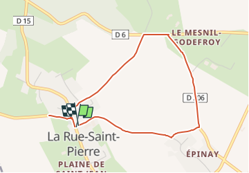
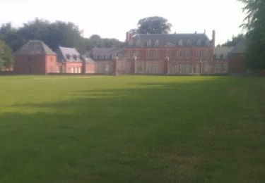
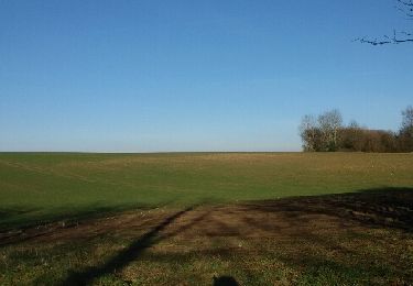
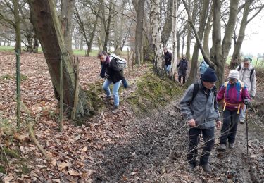
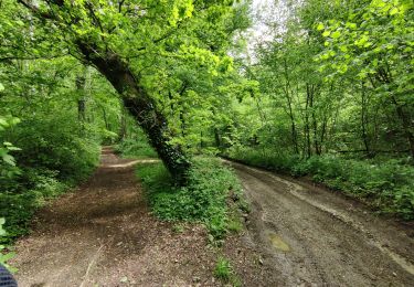
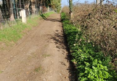
Randonnée A pied de 3,9 km à découvrir à Normandie, Seine-Maritime, La Rue-Saint-Pierre. Cette randonnée est proposée par nicole.reine@wanadoo.fr.
Description
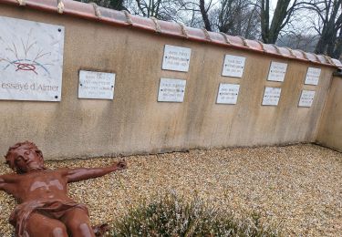
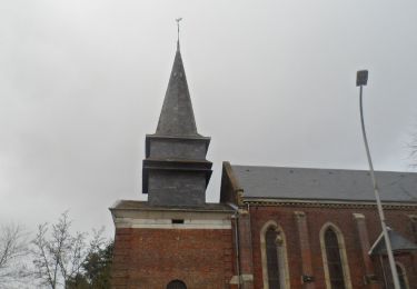
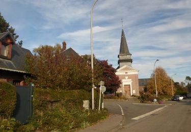
je vous conseille d'aller sur le site du patrimoine et histoire du haut cailly pour de plus ample renseignement
Localisation
Pays :
France
Région :
Normandie
Département/Province :
Seine-Maritime
Commune :
La Rue-Saint-Pierre
Localité :
Unknown
Départ:(Dec)
Départ:(UTM)
373148 ; 5491650 (31U) N.
Commentaires
Randonnées à proximité
![Randonnée Marche Quincampoix - 076-29-Quincampoix 10km -496-626 - Photo](https://media.geolcdn.com/t/375/260/ext.jpg?maxdim=2&url=https%3A%2F%2Fmedia.geolcdn.com%2Ff%2F77288098-4062-4eec-991a-4ccce3a169cf.jpg)
![Marche Marche](https://static1.geolcdn.com/sitytour/trail-icons/101.png)
076-29-Quincampoix 10km -496-626
Marche
Facile
(1)
Quincampoix,
Normandie,
Seine-Maritime,
France
![](/images/other/stat-length.png)
9,9 km | 11,2 km-effort
2h 28min
![](https://static1.geolcdn.com/siteimages/upload/files/16400158638029165_repeat_loop_refresh_sync_direction_icon.png)
Oui
![Randonnée Marche Esteville - Esteville - Domaine Emmaüs - Photo](https://media.geolcdn.com/t/375/260/ext.jpg?maxdim=2&url=https%3A%2F%2Fmedia.geolcdn.com%2Ff%2F093cbe9a-ab6c-4543-a409-04375edde29b.jpg)
![Marche Marche](https://static1.geolcdn.com/sitytour/trail-icons/101.png)
Esteville - Domaine Emmaüs
Marche
Moyen
Esteville,
Normandie,
Seine-Maritime,
France
![](/images/other/stat-length.png)
7,9 km | 8,6 km-effort
2h 44min
![](https://static1.geolcdn.com/siteimages/upload/files/16400158638029165_repeat_loop_refresh_sync_direction_icon.png)
Non
![Randonnée Marche Saint-Georges-sur-Fontaine - 20231123-St Geotges sur Fontaine - Photo](https://media.geolcdn.com/t/375/260/ext.jpg?maxdim=2&url=https%3A%2F%2Fmedia.geolcdn.com%2Ff%2Feb1ec2d6-edb9-4986-b70a-bf60a2eb5cfa.JPG)
![Marche Marche](https://static1.geolcdn.com/sitytour/trail-icons/101.png)
20231123-St Geotges sur Fontaine
Marche
Moyen
Saint-Georges-sur-Fontaine,
Normandie,
Seine-Maritime,
France
![](/images/other/stat-length.png)
11 km | 12,8 km-effort
3h 4min
![](https://static1.geolcdn.com/siteimages/upload/files/16400158638029165_repeat_loop_refresh_sync_direction_icon.png)
Oui
![Randonnée Marche Saint-Georges-sur-Fontaine - 20221015-St Geirges sur Fontaine - Photo](https://media.geolcdn.com/t/375/260/ext.jpg?maxdim=2&url=https%3A%2F%2Fmedia.geolcdn.com%2Ff%2F9e3f8a7f-e258-4312-8507-ab01809e3f7c.JPG)
![Marche Marche](https://static1.geolcdn.com/sitytour/trail-icons/101.png)
20221015-St Geirges sur Fontaine
Marche
Moyen
Saint-Georges-sur-Fontaine,
Normandie,
Seine-Maritime,
France
![](/images/other/stat-length.png)
11,1 km | 12,9 km-effort
3h 3min
![](https://static1.geolcdn.com/siteimages/upload/files/16400158638029165_repeat_loop_refresh_sync_direction_icon.png)
Oui
![Randonnée Marche Bierville - bierville 3 châteaux - Photo](https://media.geolcdn.com/t/375/260/ext.jpg?maxdim=2&url=https%3A%2F%2Fservices.sitytrail.com%2FGeolivesWS%2FDownloadMedia.ashx%3FTrailID%3D822805%26Media%3Dfix__20170827160205.jpg)
![Marche Marche](https://static1.geolcdn.com/sitytour/trail-icons/101.png)
bierville 3 châteaux
Marche
Difficile
Bierville,
Normandie,
Seine-Maritime,
France
![](/images/other/stat-length.png)
17,6 km | 20 km-effort
3h 58min
![](https://static1.geolcdn.com/siteimages/upload/files/16400158638029165_repeat_loop_refresh_sync_direction_icon.png)
Oui
![Randonnée Marche Saint-Georges-sur-Fontaine - 20150207 St Georges sur fontaine - Photo](https://media.geolcdn.com/t/375/260/ext.jpg?maxdim=2&url=https%3A%2F%2Fservices.sitytrail.com%2FGeolivesWS%2FDownloadMedia.ashx%3FTrailID%3D384193%26Media%3Dfix__20150207162004.jpg)
![Marche Marche](https://static1.geolcdn.com/sitytour/trail-icons/101.png)
20150207 St Georges sur fontaine
Marche
Facile
(1)
Saint-Georges-sur-Fontaine,
Normandie,
Seine-Maritime,
France
![](/images/other/stat-length.png)
13,1 km | 15,1 km-effort
3h 19min
![](https://static1.geolcdn.com/siteimages/upload/files/16400158638029165_repeat_loop_refresh_sync_direction_icon.png)
Oui
![Randonnée Marche Saint-Georges-sur-Fontaine - Saint Georges sur Fontaine - Photo](https://media.geolcdn.com/t/375/260/ext.jpg?maxdim=2&url=https%3A%2F%2Fmedia.geolcdn.com%2Ff%2Fc5044ecf-5de2-436f-b32f-dcf07bd85693.jpg)
![Marche Marche](https://static1.geolcdn.com/sitytour/trail-icons/101.png)
Saint Georges sur Fontaine
Marche
Difficile
(1)
Saint-Georges-sur-Fontaine,
Normandie,
Seine-Maritime,
France
![](/images/other/stat-length.png)
10,9 km | 12,6 km-effort
3h 11min
![](https://static1.geolcdn.com/siteimages/upload/files/16400158638029165_repeat_loop_refresh_sync_direction_icon.png)
Oui
![Randonnée V.T.T. Morgny-la-Pommeraye - m23 - Photo](https://media.geolcdn.com/t/375/260/ext.jpg?maxdim=2&url=https%3A%2F%2Fmedia.geolcdn.com%2Ff%2Fc0af3991-d1a0-4e02-a92e-2e6b975e656b.jpg)
![V.T.T. V.T.T.](https://static1.geolcdn.com/sitytour/trail-icons/202.png)
m23
V.T.T.
Moyen
Morgny-la-Pommeraye,
Normandie,
Seine-Maritime,
France
![](/images/other/stat-length.png)
35 km | 43 km-effort
2h 9min
![](https://static1.geolcdn.com/siteimages/upload/files/16400158638029165_repeat_loop_refresh_sync_direction_icon.png)
Oui
![Randonnée V.T.T. Morgny-la-Pommeraye - Petit parcours - Photo](https://media.geolcdn.com/t/375/260/ext.jpg?maxdim=2&url=https%3A%2F%2Fmedia.geolcdn.com%2Ff%2F868a69fa-a922-49ff-919e-00f6fea6f210.jpg)
![V.T.T. V.T.T.](https://static1.geolcdn.com/sitytour/trail-icons/202.png)
Petit parcours
V.T.T.
Facile
Morgny-la-Pommeraye,
Normandie,
Seine-Maritime,
France
![](/images/other/stat-length.png)
34 km | 39 km-effort
1h 20min
![](https://static1.geolcdn.com/siteimages/upload/files/16400158638029165_repeat_loop_refresh_sync_direction_icon.png)
Oui